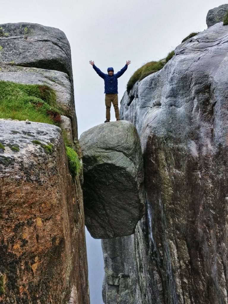
Kjeragbolten is the name of the boulder that is wedged between two mountain crevices “floating” above the Lysefjord 825 meters above sea level. This was a 3 hour hike up the mountains to fulfill one of my bucket list items which is to stand on top of this boulder for a once in a lifetime picture. A word of warning, this hike is by far the hardest hike I ever did in Norway as there are very steep sections where you have to ascend up slippery rocks while holding on chains, only for heavy rain and wind to make it even more treacherous.
How to get to Kjeragbolten
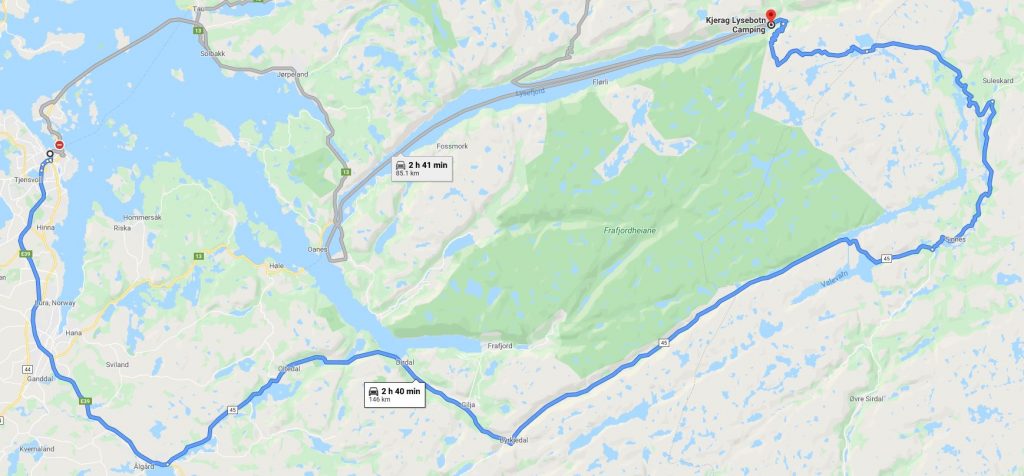
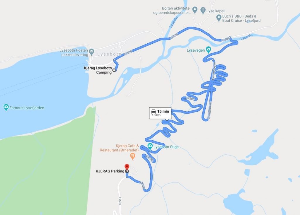
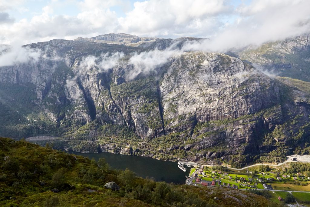
As soon as we finished our Pulpit Rock hike, we went back to Stavangar to rest up and stocked up on supplies as we were on the road for the next few days. The closest town to the Kjeragbolten hike is Lysebotn, a small town that is nested right at the end of the Lysefjord. The drive from Stavangar to Lysebotn took about 2.5 hours but the despite the long drive, the views were gorgeous. Be prepared to stop many times as every turn provides a new scenic view that is postcard worthy. The drive will take you up the mountains as you snake your way driving by round shaped rocks that is iconic for this area. On the way to the campsite, we drove by the parking lot of Kjeragbolten and decided to check it out while the day was sunny and bright.
Accomodation
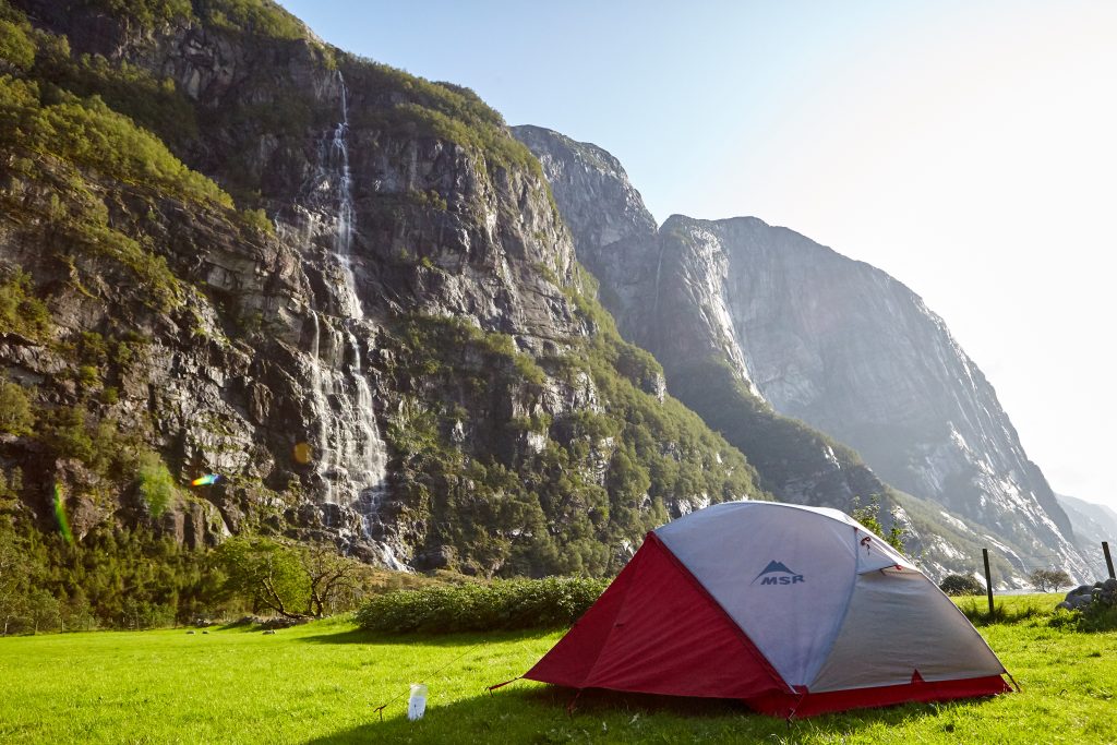
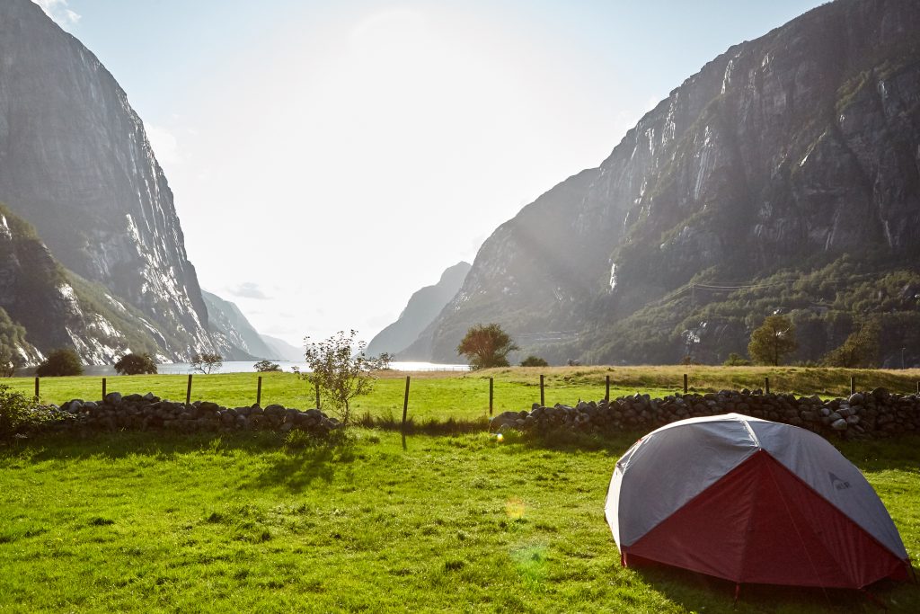
We stayed at Kjerag Lysebotn Camping, a campsite located 15 minutes drive away from the Kjerag parking lot. It has full facilities including wifi, showers, bathrooms, and a small kitchen. This campground is one of the most scenic ones I stayed at, it’s located between two mountains right next to the water’s edge of Lysefjord with a waterfall in the background. We enjoyed this campsite so much that we decided to stay two nights, especially after the exhausting Kjeragbolten hike.
The Hike
The Kjerag trail head was only 15 minutes from our campsite, just up the mountain following the snake-like roads and a long tunnel. This road was one of the most fun I had driving in Norway.
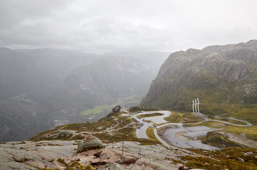
As I mentioned earlier, this hike was one of the hardest hikes I did in Norway. It was physically demanding and also extremely steep in certain areas. Combine this with the random weather in Norway and you may have yourself a windy and rainy hike escalating the difficulty level even more. We always seem to have the worst luck with the weather as it was raining heavily as we pulled into the empty parking lot. We talked to the owner there and he said due to the weather, it will be windy, foggy, and extremely wet up in the mountains and warned us it will be very challenging. Typically there are around 200 hikers in the morning by now but today there were only 10 hikers ahead of us. We were really close to calling the hike off but knowing we won’t have time to return the next day, we decided to try anyways and see how far we can get, worst case was we would turn around and go back down the mountain.
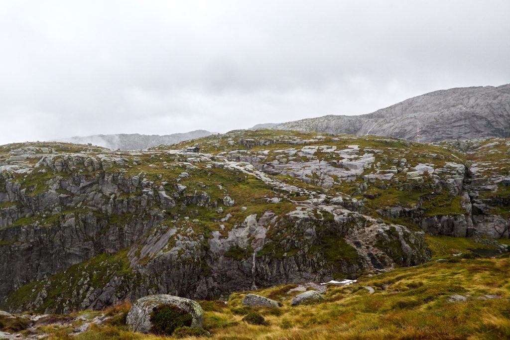
The first part of the hike was not too hard, it was solid rock with some areas that were steep and required chains to hold on. The wet conditions also made the rocks extremely slippery and we had to slow down our climb to prevent any serious injuries.
As soon as we got to the top of the first mountain, we felt the full blast of the wind as the mountain was no longer blocking it. Luckily this section of the hike was not too difficulty as it was descending the other side of the mountain to a valley that connects to the next mountain. The descent was fairly easy and the valley was also flat which made this area one of the easiest sections of the hike.
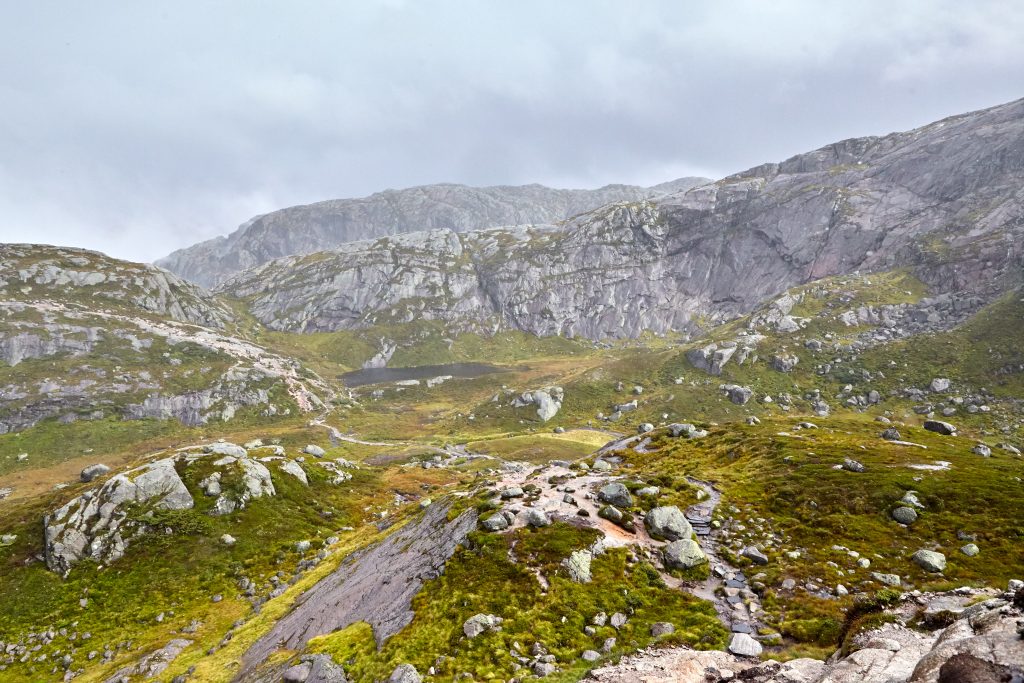
After the valley, climbing the other mountain was not too difficulty either as there were rocks set up in a staircase fashion with chains to hold on to. After this climb, you reach the next section which was a rocky valley with a safe-house nearby. There was also a river that was running a lot faster than normal due to the rain and wind.
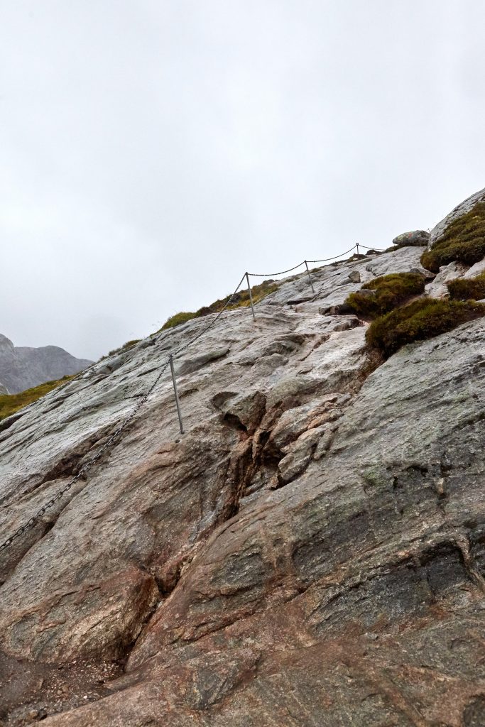
The next area was climbing the third and final mountain, which was the hardest climb as there were long steep sections with a chain to hold on to. Especially with the rain, it made it very difficulty as the rocks were slippery and we had to use the chains to pull ourselves up as we couldn’t get much grip with our shoes.
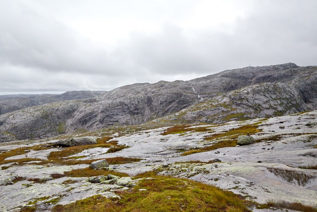
After this climb, you’ll be on top of the Kjerag mountain and it’s a fairly flat hike to the final destination. This was the second most easiest section as you just follow the red trail markers to the floating boulder, but with the fog surrounding us, we did lose track of the trail markers a few times.
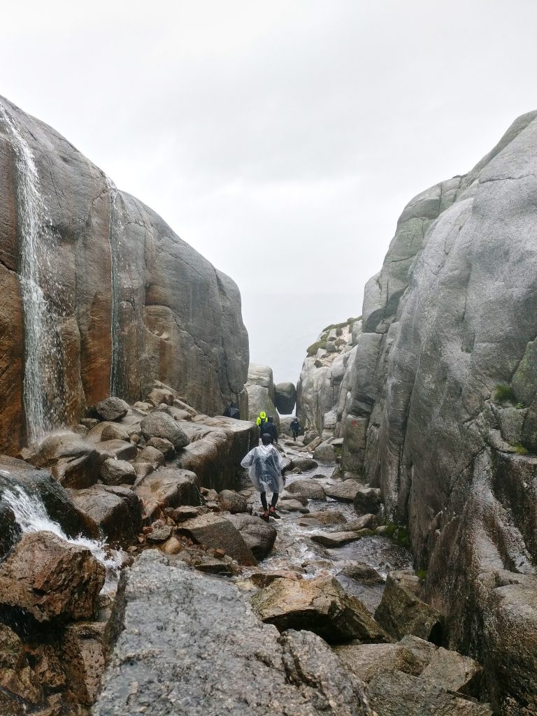
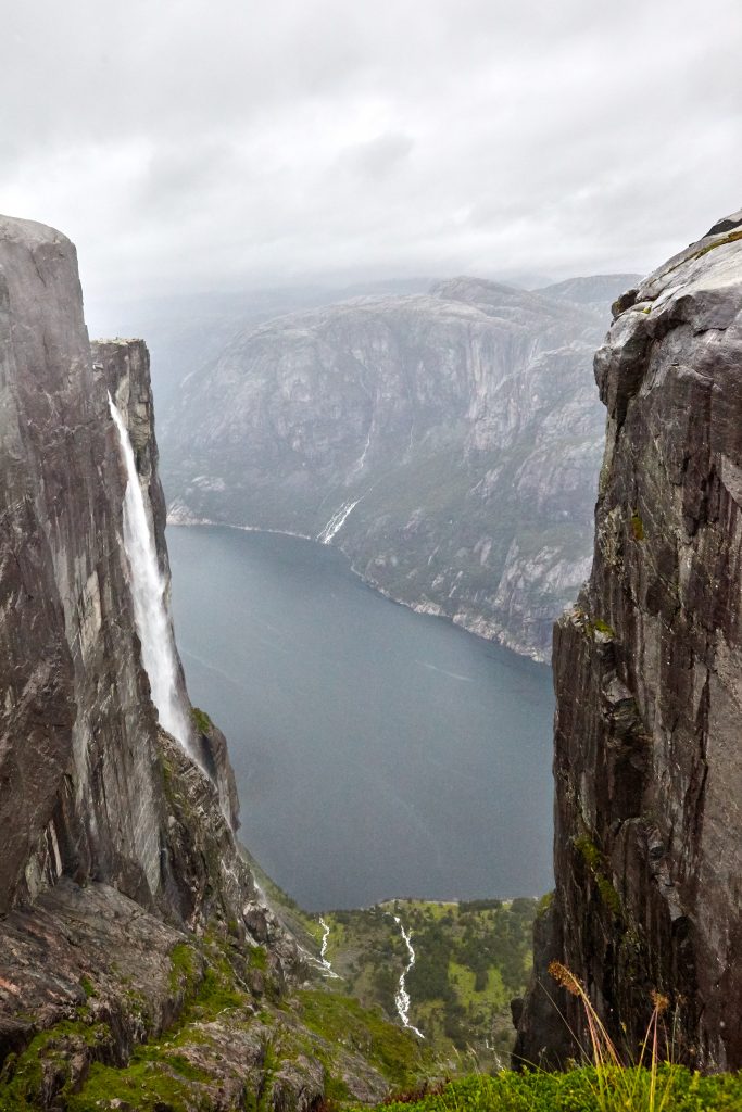
Near the end, you’ll go down a trench where a stream runs down the mountain. Be extra cautious as you climb over slippery rocks as you traverse through this narrow trench, it’s easy to slip and lose your footing. At the end of the trench is where the Kjeragbolten stands, we finally made it!
Next to the boulder is a viewpoint that is right next to the edge of the mountain. The view is amazing as you look down upon the Lysefjord below with a waterfall running along the side of the mountain.
However the prize for me is getting a picture of myself on top of the boulder. Usually there is a line up to get on top of the boulder but with the poor weather today, there was only a handful of hikers up here with zero wait time. I found getting on top of the boulder fairly tricky with the wet conditions and many thoughts crossed my mind where I could slip and fall to my death if I made a mistake. I saw one person do a hop across the gap to the boulder but knowing how wet it is, I quickly ruled that out. Then I saw another person crouch down into the gap and slowly climbed up the side of the boulder which was also the same method I decided to use as it was the safest. As I stood on the boulder, I have to admit my legs were trembling while my pictures were getting taken. Afterwards I quickly hopped across back to safety and never looked back.
We spent some time here to rest up and enjoy the view before we had to back track and head back down the mountain. During this time, the rain stopped and some fog rolled in which made it a little tricky to navigate through the flat rocky trail. Eventually the fog lifted and we quickly took more pictures that we missed out on during the morning hike as it was just too windy and rainy to take pictures. As hard of a climb the hike was, I found the climb down was even more tricky as the rocks were still slippery from the rain and a lot of care had to be taken going down. There were many times where I slipped on the steep sections back down but luckily there were chains to hold on to that stopped me from sliding down the mountain.
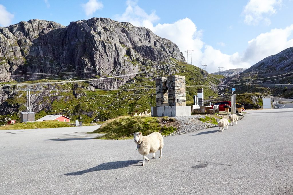
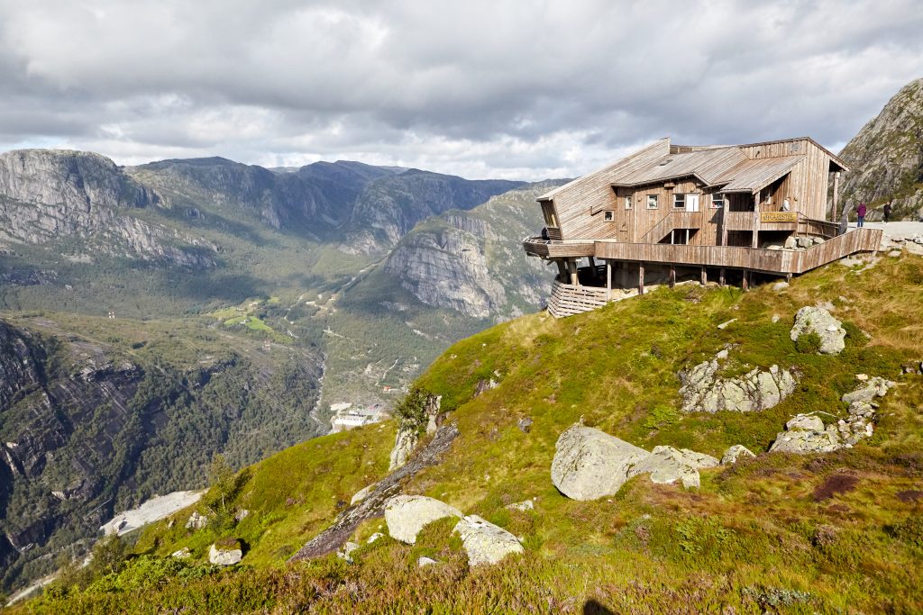
Near the bottom of the hike, there were random goats grazing right next to the trail, with one getting close enough for me to pet it. We eventually made it back down with only a scrapped elbow to show for it and went straight to the restaurant to eat some hot Norwegian food to warm us back up. Although the food was overpriced, it was surprisingly delicious. The view was amazing too as the restaurant sits on the edge of the mountain and you get a nice 180 degree view of the landscape.
Conclusion
Kjeragbolten was our second Norwegian hike and was one of the hardest hikes we ever did in Norway. Not only did the hike require a lot of physical endurance climbing up steep sections of the rock, but the weather was random as it was pouring rain in the morning, followed by fog that blanketed the top of the mountain before clearing up again to a sunny afternoon. However, to say you have stood on top of Kjeragbolten is an accomplishment on its own and definitely made this hike worth doing. As long as you come prepared with the right gear and take your time, anyone can eventually finish this challenging hike.